Driving Distance & Time from NYC to San Jose, CA
Learn the total 2026 cost of driving from NYC to San Jose, CA, including fuel expenses, tolls, rest stops, parking, mileage, and budget tips for this long-distance cross-country route.
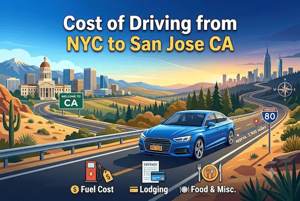
Driving from New York City to San Jose, California is a major cross-country trip covering 2,850 to 2,920 miles, depending on the exact route. The two most common routes are:
- I-80 West (fastest overall)
- I-70 West → I-15 → I-80 (balanced for scenery and road quality)
The entire journey takes approximately 42 to 48 hours of wheel time. Most travelers divide the trip across 5–7 days for comfort and safety. The road conditions vary from East Coast tollways to long Midwest plains, followed by Utah and Nevada’s high desert stretches.
Key Points:
- Distance: 2,850–2,920 miles
- Driving time: 42–48 hours
- Best route for speed: I-80 West
Total Cost of Driving This Route
The total cost of driving from NYC to San Jose in 2026 ranges from $560 to $960, based on vehicle type, MPG, fuel prices, tolls, lodging, rest breaks, and travel style. Fuel is the largest cost during this trip, followed by lodging and meals.
Key Points:
- Total estimated cost: $560–$960
- Fuel = biggest expense
- Lodging + meals form the second-largest cost group
Fuel Cost Breakdown for Driving from NYC to San Jose CA in 2026
Fuel costs are the largest variable expense when driving from NYC to San Jose, CA in 2026. The trip covers approximately 2,900 to 2,950 miles one way and requires about 116 to 123 gallons of gasoline for a vehicle averaging 24 to 25 MPG. With average U.S. gas prices ranging between $4.10 and $4.20 per gallon during 2026, most drivers can expect to spend approximately $475 to $520 on fuel for a one-way journey.
Drivers of fuel-efficient hybrid vehicles averaging 35 to 40 MPG may reduce fuel costs to around $300 to $380, while larger SUVs and pickup trucks averaging 15 to 18 MPG could spend $650 to $800 or more on gasoline.
For travelers planning a NYC to San Jose road trip, fuel budgeting is essential because the route crosses multiple regions with different gas prices. A typical midsize sedan will consume roughly 120 gallons of fuel, resulting in an estimated gasoline expense of $475 to $520.
Since the drive takes approximately 42 to 45 hours and spans nearly 3,000 miles, fuel represents the single largest direct transportation cost. For a round-trip drive between New York City and San Jose, travelers should budget approximately $950 to $1,040 for fuel alone, making route planning, fuel-efficient driving, and strategic refueling stops important factors for controlling overall road trip expenses in 2026.
Assuming a national average gas price of $4.20/gal, here’s the estimated fuel cost for the ~2,900-mile journey:
| Vehicle MPG | Gallons Needed | Estimated Fuel Cost |
|---|---|---|
| 20 MPG | ~145 gallons | ~$609 |
| 25 MPG | ~116 gallons | ~$487 |
| 30 MPG | ~97 gallons | ~$407 |
| 50 MPG (Hybrid) | ~58 gallons | ~$243 |
Electric vehicles can complete the trip for roughly $90–$150 in charging costs, depending on charging stations used.
Key Points:
- Most sedans: $407–$487 in fuel
- SUVs/trucks: $550–$650+
- Hybrids: best fuel savings
Gas Prices Along the Route (Area-Wise Comparison)
Gas prices along the route from NYC to San Jose, CA vary significantly, with the highest fuel costs typically found in the Northeast and on the West Coast. In 2026, drivers leaving New York City can expect average regular gasoline prices of approximately $4.45 to $4.55 per gallon, while Pennsylvania averages around $4.30 to $4.40 per gallon.
As the route continues through states such as Ohio, Indiana, Illinois, Nebraska, and Wyoming, fuel prices generally become more affordable, often ranging between $3.70 and $4.00 per gallon. These lower-cost regions provide excellent opportunities for road trippers to reduce the overall NYC to San Jose driving cost.
Fuel prices begin to rise again as travelers approach California, where gasoline remains among the most expensive in the nation. In 2026, average gas prices in California, including the San Jose area, are approximately $5.00 to $5.40 per gallon.
Since the trip requires roughly 116 to 123 gallons of fuel, strategically filling up in lower-cost states such as Nebraska, Wyoming, and Utah can save drivers $80 to $120 compared with purchasing most of their fuel in New York or California. Careful planning of fuel stops is one of the most effective ways to reduce total road trip expenses on this nearly 3,000-mile cross-country journey.
Fuel prices vary greatly across the states you pass through. Midwest states offer the most affordable gas, while California tends to be the most expensive.
| Region / State | Avg. 2026 Gas Price |
|---|---|
| New Jersey / Pennsylvania | $4.05–$4.20 |
| Ohio / Indiana | $3.55–$3.75 |
| Nebraska / Wyoming | $3.45–$3.70 |
| Utah / Nevada | $3.85–$4.10 |
| California (Bay Area) | $4.90–$5.40 |
Fueling up before entering California significantly reduces total trip cost.
Key Points:
- Cheapest fuel: Midwest (NE, WY)
- Most expensive: California
- Best savings: Fill up in Nevada before CA border
Mileage, Fuel Efficiency & Vehicle Type Impact
Long highway stretches allow efficient MPG for sedans and hybrids. However, mountainous terrain in Wyoming, Utah, and Nevada can cause temporary fuel inefficiencies. Large SUVs with cargo boxes or trailers may see reduced MPG by up to 20%.
Toll Charges on the Route (State-Wise Details)
Toll charges for driving from NYC to San Jose, CA in 2026 are relatively modest compared with fuel costs, despite the nearly 3,000-mile cross-country journey. Most toll expenses occur in the Northeast, particularly in New York, New Jersey, and Pennsylvania, where major bridges, tunnels, and turnpikes charge passenger vehicles between $15 and $30 per segment.
Depending on the route selected and whether an E-ZPass is used, drivers can expect total one-way toll costs of approximately $35 to $80. Travelers who avoid certain toll roads may reduce expenses but should expect slightly longer travel times.
Once past Pennsylvania and the eastern states, the majority of interstate highways through Ohio, Indiana, Illinois, Iowa, Nebraska, Wyoming, Utah, Nevada, and much of California are toll-free. The only additional charges may come from optional express lanes, urban toll facilities, or Bay Area bridges near the destination.
Drivers entering the San Francisco Bay Area may encounter bridge tolls ranging from $8 to $10 depending on the crossing used. Overall, tolls account for only a small percentage of the total NYC to San Jose driving cost, with fuel expenses of $475 to $520 remaining the primary transportation expense.
Tolls are mainly concentrated in the East Coast and Midwest. Most Western states (after Illinois) are nearly toll-free.
| Toll Region | Estimated Toll Cost (2026) |
|---|---|
| NYC Bridges/Tunnels | $12–$18 |
| New Jersey Turnpike | $5–$8 |
| Pennsylvania Turnpike | $18–$32 |
| Ohio / Indiana Turnpike (combined) | $10–$15 |
| Western States | $0 |
Total Estimated Tolls: $30–$75
Key Points:
- East Coast tolls form the majority
- West of Illinois = almost fully toll-free
- Toll-avoid routes available through I-81 early on
Parking Costs Upon Arrival
Parking in San Jose varies depending on the neighborhood or district. Downtown San Jose and tech-hub zones near Silicon Valley may be costlier.
| Area in San Jose | Avg. Parking Cost |
|---|---|
| Downtown San Jose | $10–$30/day |
| Silicon Valley business zones | $5–$20/day |
| Suburban neighborhoods | Free or minimal |
Hotels often offer free parking outside the downtown core.
Key Points:
- Downtown parking moderate in cost
- Suburban hotels = major savings
- Tech-district parking varies widely
Additional Driving Expenses (Meals, Stops, Wear & Tear)
Cross-country driving includes additional expenses beyond fuel:
- Meals for 5–7 days: $90–$180 per person
- Snacks/drinks: $20–$40
- Wear & tear (tires/oil/etc.): $25–$50
- Lodging (4–6 nights): $60–$130/night
Key Points:
- Lodging adds $240–$780 depending on number of nights
- Meal costs significant on long trips
- Multiple drivers reduce need for extra hotel stays
Cheapest Time of Day & Best Season to Drive
Leaving NYC between 3 AM and 6 AM helps avoid heavy morning congestion and improves early trip momentum.
Best travel seasons: Spring and Fall — fewer storms, mild temps, safer mountain & desert driving.
Avoid:
- Winter: Snow and ice in Midwest/Rockies
- Peak summer: High desert heat in Nevada & California
Key Points:
- Leave early morning for best flow
- Spring/fall ideal for long-distance driving
- Avoid extreme weather seasons
Cost Comparison: Driving vs. Flying vs. Bus/Train
| Mode | Price | Travel Time | Notes |
|---|---|---|---|
| Driving | $560–$960 | 5–7 days | Flexible, scenic, luggage-friendly |
| Flying | $180–$350 | ~6 hours | Fastest, cheapest for solo travel |
| Bus | $200–$300 | 55+ hours | Affordable but slow |
| Train | $220–$380 | 60–72 hours | Scenic; fewer direct routes |
Key Points:
- Driving best for flexibility and multi-stop sightseeing
- Flying best for time savings
- Train/bus more suitable for low-budget travel without a car
Budget Tips to Reduce the Overall Driving Cost
- Refuel in Midwest and Nevada before entering California
- Choose budget motels outside metro zones
- Avoid toll routes early by taking I-81
- Bring meals/snacks to cut food expenses
- Drive during off-peak hours to save fuel
Key Points:
- Smart fuel stops reduce cost by $25–$40
- Avoiding tolls saves $20–$40
- Self-prepped meals cut costs significantly
Route Options & Road Conditions to Expect
Route 1 (Fastest): I-80 West → I-680 → San Jose
Consistent highway travel with minimal detours. Straightforward and widely used by cross-country drivers.
Route 2 (Scenic Balanced): I-70 → I-15 → I-80 → CA-84 → San Jose
Offers a blend of mountain and desert scenery. Slightly higher elevation changes.
Road Conditions Overview:
- Midwest: long, straight, smooth highways
- Rockies: elevation changes, steep grades
- Nevada/California: desert climate, long gaps between services
Key Points:
- I-80 = smoothest for long-distance travel
- Mountain stretches require caution
- Desert areas require hydration planning
Travel Time During Peak vs. Off-Peak Hours
From NYC to Ohio, leaving during peak hours adds 1–2 hours. Western states have minimal traffic except near big metro centers like Salt Lake City, Sacramento, and Bay Area.
Key Points:
- NYC departure timing crucial
- West Coast traffic increases near Bay Area
- Off-peak = smoother travel throughout
Related Routes from NYC:
Cost of Driving from NYC to Dallas TX
NYC to San Antonio TX Gas Cost
Final Cost Summary of the Trip
Driving from NYC to San Jose in 2026 costs $560–$960, depending on vehicle efficiency, lodging, tolls, and fuel strategy. Solid planning, efficient refueling, smart routing, and off-peak travel keep this long-distance trip manageable and enjoyable.
Key Points:
- Total cost: $560–$960
- Fuel: $407–$609 for most vehicles
- Tolls: $30–$75
- Trip duration: 5–7 days
Source for Info: https://www.fhwa.dot.gov
FAQs
1. How many miles is NYC to San Jose by car?
Around 2,850–2,920 miles.
2. How much fuel will I need?
Between ~58 and ~145 gallons depending on vehicle MPG.
3. How long does it take to drive?
Around 42–48 hours of driving, typically spread across 5–7 days.
4. Which states offer the cheapest gas?
Nebraska, Wyoming, and Nevada typically offer the lowest fuel prices.
5. What is the best route for safety and speed?
I-80 West is the best all-around route.
Summary Table
| Topic | Summary |
|---|---|
| Distance | 2,850–2,920 miles |
| Total Cost | $560–$960 |
| Fuel Cost | $407–$609 |
| Tolls | $30–$75 |
| Parking (San Jose) | $5–$30/day |
| Best Route | I-80 West |
| Best Travel Time | 3–6 AM |
| Cheapest Fuel | Nebraska, Wyoming, Nevada |